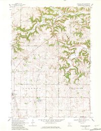
1968 Map of Goodhue East
USGS Topo · Published 1982About this map
Minnesota Memorial Hardwood State Forest dominates the eastern ridges of this landscape, where the deeply carved valleys of Wells Creek and its tributaries meet the township borders of Belvidere and Hay Creek. The mapping reveals a rural infrastructure defined by legacy boundaries and industrial history, notably the Old Indian Forest Boundary and an Old Railroad Grade that winds through the western sections near Goodhue.
Find a feature on this map
17 named features on this map. Tap any name to fly to it.
Don’t see what you’re looking for? This feature index may not catch every label — zoom into the map to look around manually.
Map Details
Editions of this 1968 Goodhue East Map
2 editions found
Other maps of this area

1940 · Maiden Rock
USGS Topo · 1:62,500

1944 · Red Wing
USGS Topo · 1:62,500

1950 · Maiden Rock
USGS Topo · 1:62,500

1951 · Lake City
USGS Topo · 1:62,500

1952 · Red Wing
USGS Topo · 1:62,500

1953 · Saint Paul
USGS Topo · 1:250,000

1959 · Saint Paul
USGS Topo · 1:250,000

1968 · Goodhue East
USGS Topo · 1:24,000

1968 · Zumbrota
USGS Topo · 1:24,000

1968 · Mazeppa
USGS Topo · 1:24,000