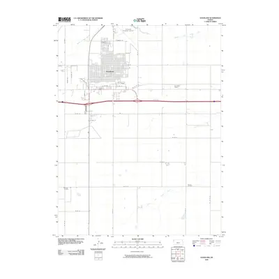
2009 Map of Goodland
USGS Topo · Published 2009About this map
Goodland serves as the focal point of this High Plains landscape, exhibiting a dense street grid that reflects its role as a regional hub in Sherman County. The town is situated between the branching waters of Middle Fork Sappa Creek to the north and South Fork Sappa Creek to the south. Transportation infrastructure is prominent, with the Industrial Loop and US Hwy 24 Bus connecting the commercial center to the broader region. Aviation history is well-represented by both the Goodland Municipal Airport and the smaller Fortmeyer Airport. For genealogists, the map provides precise locations for several burial grounds, including Goodland Cemetery, Whistler Cemetery, and Frerichs Cemetery. The presence of the name Eustis southeast of the main town center points to the historical layers of settlement in this part of Kansas.
Find a feature on this map
36 named features on this map. Tap any name to fly to it.
Don’t see what you’re looking for? This feature index may not catch every label — zoom into the map to look around manually.
Map Details
Editions of this 2009 Goodland Map
This is the sole edition of this map. No revisions or reprints were ever made.
Other maps of this area

1954 · Goodland
USGS Topo · 1:250,000

1956 · Goodland
USGS Topo · 1:250,000

1957 · Goodland
USGS Topo · 1:250,000

1959 · Harris Draw
USGS Topo · 1:62,500

1959 · Horsethief Draw
USGS Topo · 1:62,500

1966 · Goodland NW
USGS Topo · 1:24,000

1966 · Goodland
USGS Topo · 1:24,000

1966 · Edson
USGS Topo · 1:24,000

1966 · Ruleton NE
USGS Topo · 1:24,000

1966 · Goodland NE
USGS Topo · 1:24,000