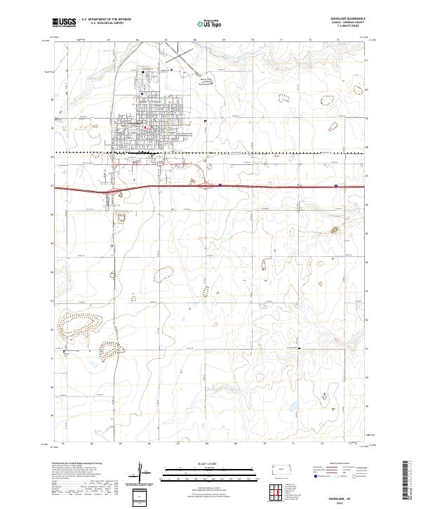
2022 Map of Goodland
USGS Topo · Published 2022About this map
Goodland serves as the primary hub of this High Plains landscape, organized around its central Sherman County Courthouse and a dense grid of residential streets. The town's layout reflects a classic western agricultural center, where the built environment abruptly transitions into the vast section-line road network that defines the surrounding prairie. Educational and logistical importance is highlighted by the presence of Northwest Kansas Technical College and the sprawling runways of Renner Field / Goodland Municipal Airport just to the northeast. Beyond the town limits, the terrain is marked by the subtle drainage patterns of the Middle Fork Sappa Creek and the South Fork Sappa Creek. These watercourses provided essential geography for early settlers, as evidenced by established burial grounds like Goodland Cemetery, Frerichs Cemetery, and Whistler Cemetery scattered across the township lines.
Find a feature on this map
87 named features on this map. Tap any name to fly to it.
Don’t see what you’re looking for? This feature index may not catch every label — zoom into the map to look around manually.
Map Details
Editions of this 2022 Goodland Map
This is the sole edition of this map. No revisions or reprints were ever made.
Other maps of this area

1954 · Goodland
USGS Topo · 1:250,000

1956 · Goodland
USGS Topo · 1:250,000

1957 · Goodland
USGS Topo · 1:250,000

1959 · Harris Draw
USGS Topo · 1:62,500

1959 · Horsethief Draw
USGS Topo · 1:62,500

1966 · Goodland NW
USGS Topo · 1:24,000

1966 · Goodland
USGS Topo · 1:24,000

1966 · Edson
USGS Topo · 1:24,000

1966 · Ruleton NE
USGS Topo · 1:24,000

1966 · Goodland NE
USGS Topo · 1:24,000