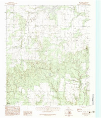
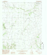
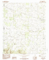
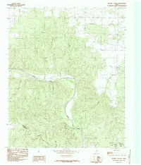
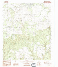
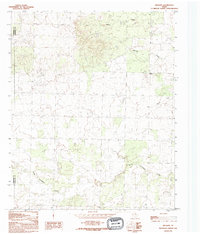
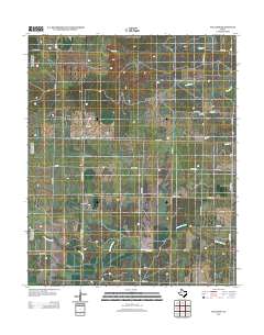
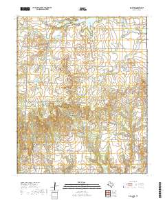
1960 Map of Goodlett
USGS Topo · Published 1979About this map
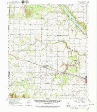
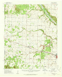
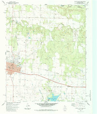
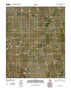
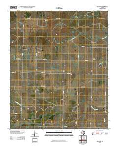
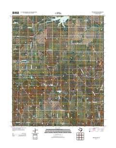
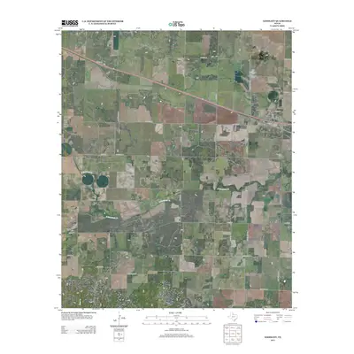
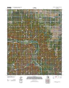
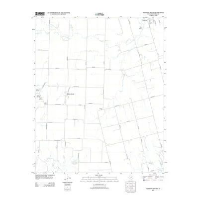
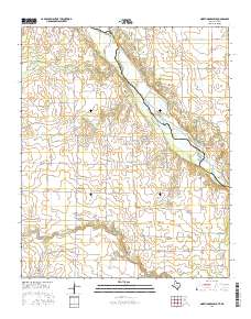
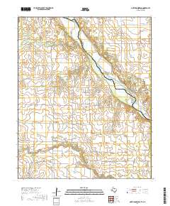
Red River braids along the northern boundary of this Hardeman County landscape, framing a region defined by its rail-driven economy and specialized industrial sites. The southern portion of the sheet is anchored by Quanah, where the intersection of the Fort Worth and Denver and the Acme and Pacific railroads once hummed with activity. Nearby, the community of Acme is surrounded by a concentration of quarries and a Strip Mine, reflecting the local gypsum industry that fueled these settlements.
Find a feature on this map
37 named features on this map. Tap any name to fly to it.
Don’t see what you’re looking for? This feature index may not catch every label — zoom into the map to look around manually.
Map Details
Editions of this 1960 Goodlett Map
2 editions found
Historical Maps of Quanah Through Time
57 maps found
1927 Quanah 3-a
Hardeman County, TX
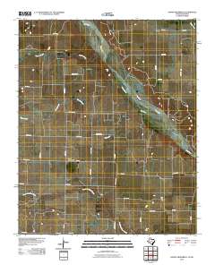
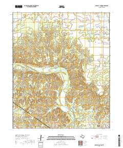
1958 Medicine Mound
Hardeman County, TX
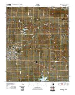
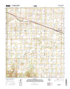
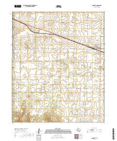
1960 Goodlett
Hardeman County, TX
1983 Big Mound
Hardeman County, TX
1983 Medicine Mound
Hardeman County, TX
1984 Goodlett
Hardeman County, TX
1984 Maybell Canyon
Hardeman County, TX
1984 Quanah East
Hardeman County, TX
1984 Quanah West
Hardeman County, TX
1984 Willams
Hardeman County, TX
1985 North Groesbeck
Hardeman County, TX
1990 Big Mound
Hardeman County, TX
1990 Goodlett
Hardeman County, TX
1990 Maybell Canyon
Hardeman County, TX
1990 Medicine Mound
Hardeman County, TX

1990 Quanah West
Hardeman County, TX
1990 Willams
Hardeman County, TX
2010 Big Mound
Hardeman County, TX
2010 Goodlett
Hardeman County, TX
2010 Maybell Canyon
Hardeman County, TX
2010 Medicine Mound
Hardeman County, TX
2010 North Groesbeck
Hardeman County, TX
2010 Quanah East
Hardeman County, TX
2010 Quanah West
Hardeman County, TX
2010 Williams
Hardeman County, TX
2012 Big Mound
Hardeman County, TX
2012 Goodlett
Hardeman County, TX
2012 Maybell Canyon
Hardeman County, TX
2012 Medicine Mound
Hardeman County, TX
2012 North Groesbeck
Hardeman County, TX
2012 Quanah East
Hardeman County, TX
2012 Quanah West
Hardeman County, TX
2012 Williams
Hardeman County, TX

2016 Big Mound
Hardeman County, TX
2016 Goodlett
Hardeman County, TX
2016 Maybell Canyon
Hardeman County, TX
2016 Medicine Mound
Hardeman County, TX
2016 North Groesbeck
Hardeman County, TX
2016 Quanah East
Hardeman County, TX
2016 Quanah West
Hardeman County, TX
2016 Williams
Hardeman County, TX
2019 Big Mound
Hardeman County, TX
2019 Goodlett
Hardeman County, TX
2019 Maybell Canyon
Hardeman County, TX
2019 Medicine Mound
Hardeman County, TX
2019 North Groesbeck
Hardeman County, TX
2019 Quanah East
Hardeman County, TX
2019 Quanah West
Hardeman County, TX
2019 Williams
Hardeman County, TX
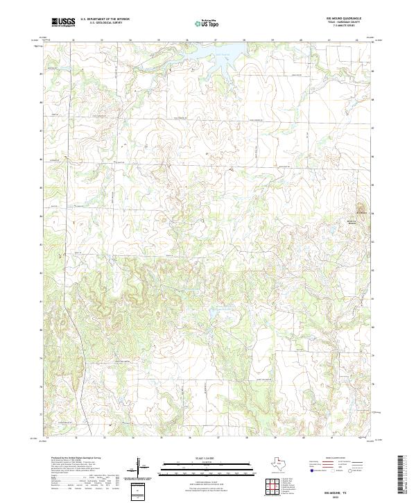
2022 Big Mound
Hardeman County, TX
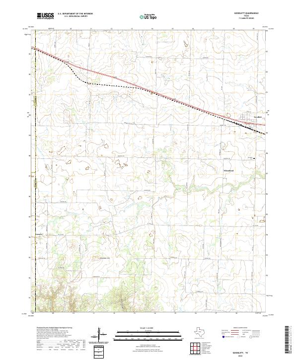
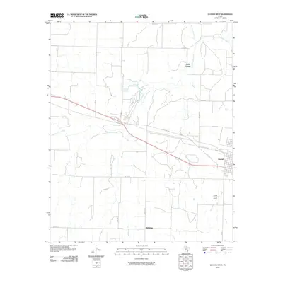
2022 Goodlett
Hardeman County, TX
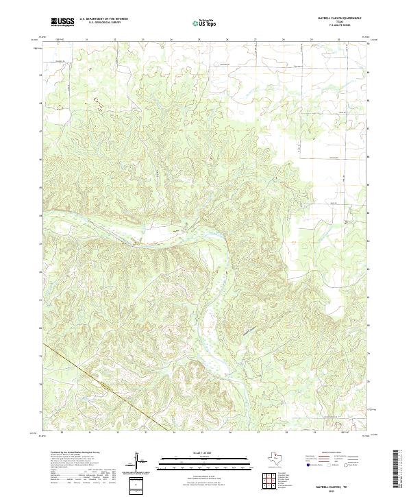
2022 Maybell Canyon
Hardeman County, TX
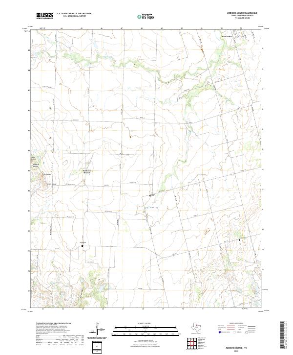
2022 Medicine Mound
Hardeman County, TX
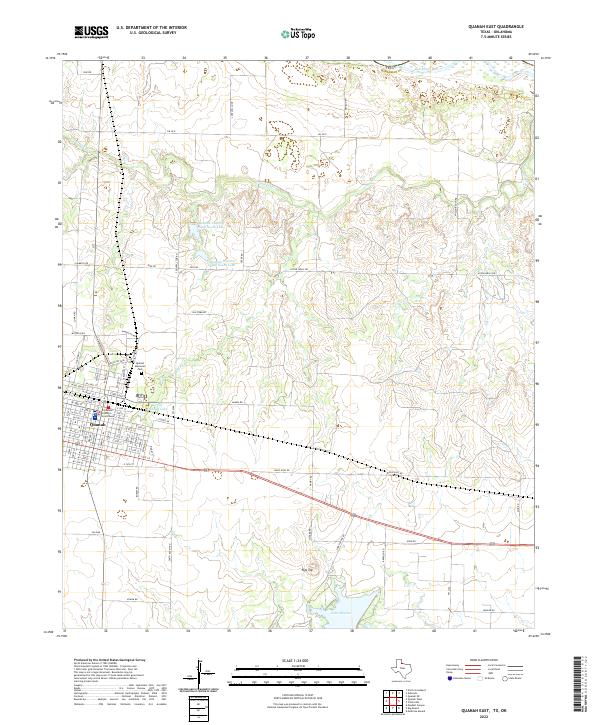
2022 Quanah East
Hardeman County, TX
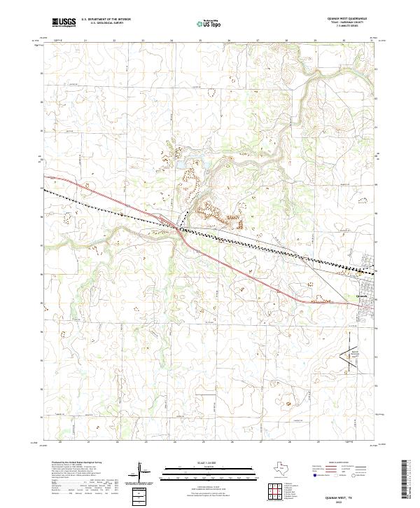
2022 Quanah West
Hardeman County, TX
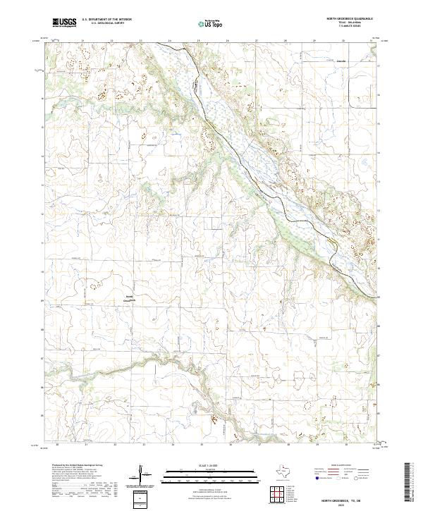
2023 North Groesbeck
Hardeman County, TX
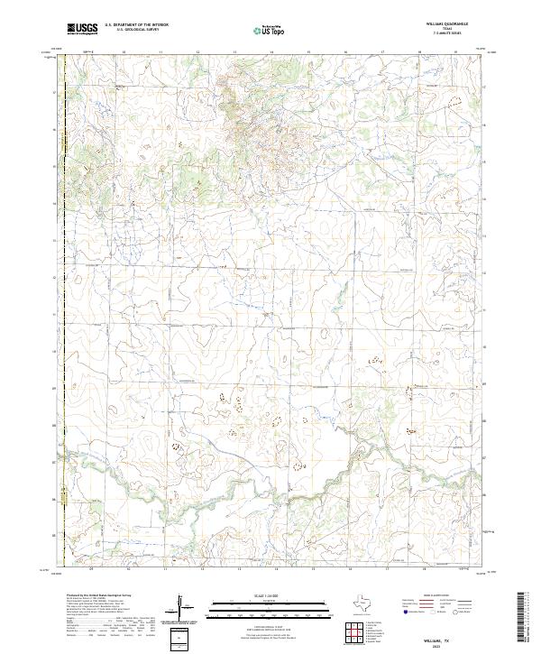
2023 Williams
Hardeman County, TX