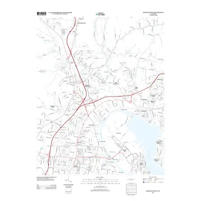
2013 Map of Goodlettsville
USGS Topo · Published 2013About this map
The Cumberland River curves through the heart of this Nashville-area survey, defining the industrial and recreational landscape of the early 21st century. The river separates the sprawling residential developments of Madison and Edenwold from Hadley Bend, where the Old Hickory Bridge provides a vital link between the suburban north and the historic industrial hub of Old Hickory. Along the northern banks, Rayon City and the Ellers Golf Course sit adjacent to the river’s wide reaches, while the Anchor High Marina serves the boating community near Rockland.
Find a feature on this map
409 named features on this map. Tap any name to fly to it.
Don’t see what you’re looking for? This feature index may not catch every label — zoom into the map to look around manually.
Map Details
Editions of this 2013 Goodlettsville Map
This is the sole edition of this map. No revisions or reprints were ever made.
Other maps of this area

1903 · Nashville
USGS Topo · 1:125,000

1931 · Ridgetop
USGS Topo · 1:62,500

1932 · Hermitage
USGS Topo · 1:62,500

1932 · Nashville
USGS Topo · 1:62,500

1935 · Ridgetop
USGS Topo · 1:62,500

1942 · Gallatin
USGS Topo · 1:100,000

1942 · Lebanon
USGS Topo · 1:100,000

1952 · Goodlettsville
USGS Topo · 1:24,000

1952 · Hendersonville
USGS Topo · 1:24,000

1952 · Hermitage
USGS Topo · 1:24,000