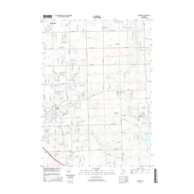
2014 Map of Goodrich
USGS Topo · Published 2014About this map
Atlas and Goodrich anchor this landscape in southeastern Genesee County, where the transition from suburban expansion near Burton and Grand Blanc meets the historic mill sites and water bodies of the Kearsley and Thread Creek basins. The local geography is defined by the impoundments at Atlas Millpond and Goodrich Millpond, remnants of early settlement industry. For those documenting family history, numerous burial grounds are detailed across the township lines, including Peace Memory Gardens, Pine Grove Cem, and Oakwood Cem. The map illustrates a dense network of modern residential development intertwined with larger natural features like Shinanguag Lake and Gale Lake. The intricate survey of these suburban and rural fringes reveals the persistent influence of water-driven settlement patterns on the 21st-century landscape.
Find a feature on this map
186 named features on this map. Tap any name to fly to it.
Don’t see what you’re looking for? This feature index may not catch every label — zoom into the map to look around manually.
Map Details
Editions of this 2014 Goodrich Map
This is the sole edition of this map. No revisions or reprints were ever made.
Other maps of this area

1920 · Flint
USGS Topo · 1:62,500

1920 · Holly
USGS Topo · 1:62,500

1922 · Holly
USGS Topo · 1:62,500

1922 · Flint
USGS Topo · 1:62,500

1943 · Holly
USGS Topo · 1:62,500

1943 · Flint
USGS Topo · 1:62,500

1943 · Ortonville
USGS Topo · 1:24,000
1945 · Ortonville
USGS Topo · 1:24,000

1945 · Hadley
USGS Topo · 1:24,000
1945 · Davisburg
USGS Topo · 1:24,000