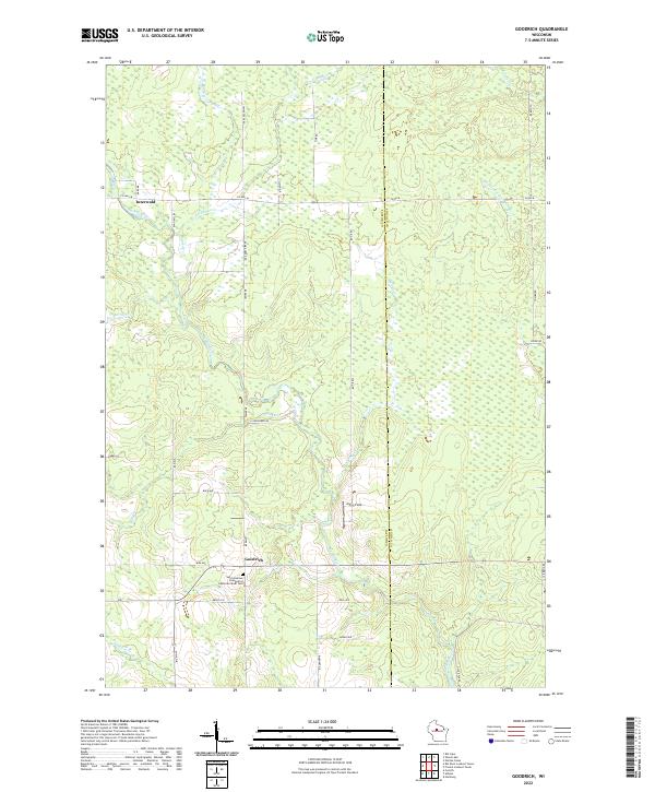
2022 Map of Goodrich
USGS Topo · Published 2022About this map
The Big Rib River and its numerous tributaries, including Lemke Cr and Mink Cr, define the drainage patterns across this rural landscape on the border of Taylor and Lincoln counties. The small settlement of Goodrich serves as a local anchor in the southern portion of the quadrangle, notably home to the Saint Andrews Evangelical Lutheran Parish Cem. Further north, the community of Interwald is situated near the junction of Co HWY M and River RD. The terrain is characterized by a mix of wetlands and agricultural clearings such as John's Field, connected by a network of local routes like Lemke Creek Rd and Tower Rd. This modern survey details the persistent rural character of the region, where the hydrology of the Middle Fork Copper River and Joe Martin Cr continues to shape land use and property boundaries along the section lines.
Find a feature on this map
41 named features on this map. Tap any name to fly to it.
Don’t see what you’re looking for? This feature index may not catch every label — zoom into the map to look around manually.
Map Details
Editions of this 2022 Goodrich Map
This is the sole edition of this map. No revisions or reprints were ever made.
Other maps of this area

1902 · Marathon
USGS Topo · 1:125,000

1945 · Rib Lake
USGS Topo · 1:48,000

1947 · Rib Lake
USGS Topo · 1:48,000

1949 · Rib Lake
USGS Topo · 1:48,000

1950 · Spirit Falls
USGS Topo · 1:48,000

1951 · Athens
USGS Topo · 1:48,000

1951 · Hamburg
USGS Topo · 1:48,000

1952 · Spirit Falls
USGS Topo · 1:48,000

1953 · Rice Lake
USGS Topo · 1:250,000

1954 · Iron Mountain
USGS Topo · 1:250,000