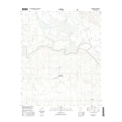
2016 Map of Goodwater
USGS Topo · Published 2016About this map
The confluence of the Little River and the Mountain Fork river defines the hydrological character of this McCurtain County landscape. Within the boundaries of the Ouachita National Forest, the terrain is marked by a complex network of wetlands and oxbow features, including Grassy Lake, Forked Lake, and the meandering Crooked Cr. The settlement of Goodwater serves as a central point, situated near the headwaters of Goodwater Cr, while Shinewell anchors the southeastern portion of the map. These small communities are historically tied to the timber and land management of the region, evidenced by the prevalence of forestry-related routes like Weyerhaeuser Rd. Local heritage is preserved at sites such as Philadelphia Cem and Panki Bok Cem, the latter located near the drainage of Panki Bok Cr.
Find a feature on this map
43 named features on this map. Tap any name to fly to it.
Don’t see what you’re looking for? This feature index may not catch every label — zoom into the map to look around manually.
Map Details
Editions of this 2016 Goodwater Map
This is the sole edition of this map. No revisions or reprints were ever made.
Other maps of this area

1902 · Lukfata
USGS Topo · 1:125,000

1913 · De Queen
USGS Topo · 1:125,000

1950 · Mcalester
USGS Topo · 1:250,000

1950 · Shults
USGS Topo · 1:24,000

1950 · Haworth
USGS Topo · 1:24,000

1950 · Goodwater
USGS Topo · 1:24,000

1950 · Bokhoma
USGS Topo · 1:24,000

1951 · Haworth
USGS Topo · 1:24,000

1951 · Bokhoma
USGS Topo · 1:24,000

1951 · Shults
USGS Topo · 1:24,000