
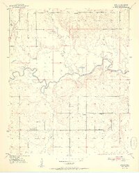
1951 Map of Shults
USGS Topo · Published 1951About this map
The Little River winds through the heart of the McCurtain County countryside in the early 1950s, creating a landscape defined by deep meanders and several seasonal oxbows like Deeberry Lake. Settlement patterns follow the high ground and section lines away from the river’s floodplain, anchored by small rural centers such as Shults and Redland. This era shows a community deeply rooted in its local institutions, evidenced by the high density of country churches including Hill Chapel, Mt Zion Ch, and Douglas Chapel, as well as the Redland Cem and the Welch Store.
Find a feature on this map
22 named features on this map. Tap any name to fly to it.
Don’t see what you’re looking for? This feature index may not catch every label — zoom into the map to look around manually.
Map Details
Editions of this 1951 Shults Map
2 editions found
Other maps of this area

1902 · Lukfata
USGS Topo · 1:125,000

1950 · Mcalester
USGS Topo · 1:250,000

1950 · Idabel
USGS Topo · 1:24,000

1950 · Shults
USGS Topo · 1:24,000

1950 · Haworth
USGS Topo · 1:24,000

1950 · Goodwater
USGS Topo · 1:24,000

1950 · Bokhoma
USGS Topo · 1:24,000

1951 · Idabel
USGS Topo · 1:24,000

1951 · Idabel SE
USGS Topo · 1:24,000

1951 · Haworth
USGS Topo · 1:24,000