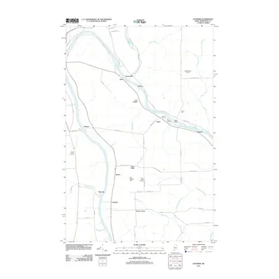
2011 Map of Goodwin
USGS Topo · Published 2011About this map
The Aroostook River carves a winding path through this northern Maine landscape, serving as a geographic anchor for numerous riverside settlements. This 2011 survey documents a community defined by its agricultural grid and early industry, notably at Grimes Mill and East Lyndon. The area's genealogical history is well-preserved through several burial grounds, including the Old Catholic Cemetery and Walton Cemetery near the riverbanks, as well as the Green Ridge Cemetery further inland. Small crossroads and rail-adjacent locales like Maysville, Sawyer Corner, and Goodwin highlight the dispersed settlement pattern of Aroostook County. Further north, the confluence with the Little Madawaska River and features like Haley Island and Old Higgins Hill define the varied terrain beyond the structured road network.
Find a feature on this map
58 named features on this map. Tap any name to fly to it.
Don’t see what you’re looking for? This feature index may not catch every label — zoom into the map to look around manually.
Map Details
Editions of this 2011 Goodwin Map
This is the sole edition of this map. No revisions or reprints were ever made.
Other maps of this area

1929 · Caribou
USGS Topo · 1:48,000

1930 · Fort Fairfield
USGS Topo · 1:48,000

1932 · Caribou
USGS Topo · 1:62,500

1933 · Fort Fairfield
USGS Topo · 1:62,500

1935 · Presque Isle
USGS Topo · 1:62,500

1936 · Mars Hill
USGS Topo · 1:48,000

1940 · Mars Hill
USGS Topo · 1:62,500

1951 · Mars Hill
USGS Topo · 1:62,500

1951 · Fort Fairfield
USGS Topo · 1:62,500

1953 · Fort Fairfield NW
USGS Topo · 1:24,000