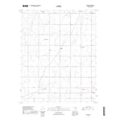
2018 Map of Goodwin
USGS Topo · Published 2018About this map
Goodwin serves as a central point in this Ellis County landscape, where the High Plains terrain is etched by a complex drainage system flowing toward the southeast. The map reveals a rural community structure defined by a rigorous grid of section-line roads, such as E0570 Rd and N1730 Rd, which provide access to isolated farmsteads and legacy sites. Notable for genealogists are the dispersed burial grounds that anchor the local history, including Christ Lutheran Cem near the northern boundary and Ebenezer Baptist Cem situated west of the main settlement.
Find a feature on this map
35 named features on this map. Tap any name to fly to it.
Don’t see what you’re looking for? This feature index may not catch every label — zoom into the map to look around manually.
Map Details
Editions of this 2018 Goodwin Map
This is the sole edition of this map. No revisions or reprints were ever made.
Other maps of this area

1954 · Perryton
USGS Topo · 1:250,000

1955 · Woodward
USGS Topo · 1:250,000

1958 · Perryton
USGS Topo · 1:250,000

1958 · Woodward
USGS Topo · 1:250,000
1969 · Shattuck
USGS Topo · 1:24,000
1969 · Gage
USGS Topo · 1:24,000
1970 · Arnett
USGS Topo · 1:24,000
1970 · Arnett SE
USGS Topo · 1:24,000
1970 · Arnett SW
USGS Topo · 1:24,000
1970 · Goodwin
USGS Topo · 1:24,000