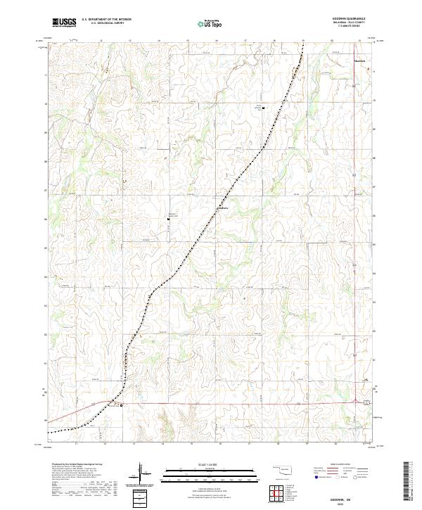
2022 Map of Goodwin
USGS Topo · Published 2022About this map
The settlement of Goodwin sits at the heart of this Ellis County landscape, where the High Plains terrain is etched by the drainage networks of Rock Cr and Hog Cr. This region preserves its rural character through a grid of section-line roads, such as e0580 RD, and the enduring presence of local community anchors. For those tracing family histories, the map identifies key burial grounds including the Ebenezer Baptist Cem and the Christ Lutheran Cem further north. In the northeast corner, the outskirts of Shattuck appear, while the southern reach is defined by the flow of W Red Bluff Cr. The inclusion of Oil Field Rd hints at the energy industry's footprint on this agricultural terrain, which remains largely defined by the sprawling boundaries of T20N R26W and its neighboring townships.
Find a feature on this map
33 named features on this map. Tap any name to fly to it.
Don’t see what you’re looking for? This feature index may not catch every label — zoom into the map to look around manually.
Map Details
Editions of this 2022 Goodwin Map
This is the sole edition of this map. No revisions or reprints were ever made.
Other maps of this area

1954 · Perryton
USGS Topo · 1:250,000

1955 · Woodward
USGS Topo · 1:250,000

1958 · Perryton
USGS Topo · 1:250,000

1958 · Woodward
USGS Topo · 1:250,000

1969 · Shattuck
USGS Topo · 1:24,000

1969 · Gage
USGS Topo · 1:24,000

1970 · Arnett
USGS Topo · 1:24,000

1970 · Arnett SE
USGS Topo · 1:24,000
1970 · Arnett SW
USGS Topo · 1:24,000

1970 · Goodwin
USGS Topo · 1:24,000