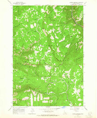
1963 Map of Goodwin Meadows
USGS Topo · Published 1965About this map
Nez Perce National Forest dominates this mid-century survey of Idaho's mountainous interior, where the South Fork Clearwater River carves a deep valley through the northern terrain. The landscape is a network of ridges and meadows utilized for both timber management and early recreation. Recreational development is evident at the Snow Haven Ski Area, complete with Ski Lifts, and various federal sites like the Fish Creek Meadow Campground and Fish Creek Recreation Area.
Find a feature on this map
54 named features on this map. Tap any name to fly to it.
Don’t see what you’re looking for? This feature index may not catch every label — zoom into the map to look around manually.
Map Details
Editions of this 1963 Goodwin Meadows Map
2 editions found
Other maps of this area

1931 · Buffalo Hump
USGS Topo · 1:125,000

1934 · Buffalo Hump
USGS Topo · 1:125,000

1955 · Grangeville
USGS Topo · 1:250,000

1956 · Elk City
USGS Topo · 1:250,000

1959 · Grangeville
USGS Topo · 1:250,000

1960 · Elk City
USGS Topo · 1:250,000

1963 · McKinzie Creek
USGS Topo · 1:24,000

1963 · Goodwin Meadows
USGS Topo · 1:24,000

1963 · Grangeville West
USGS Topo · 1:24,000

1963 · White Bird Hill
USGS Topo · 1:24,000