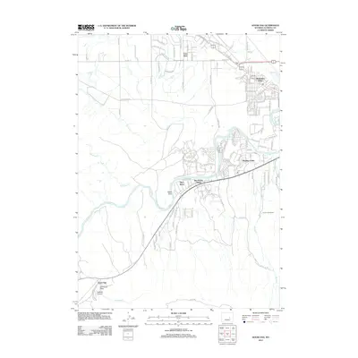
2012 Map of Goose Egg
USGS Topo · Published 2012About this map
The N Platte River meanders through the central portion of this 2012 survey, shaping the development of the Casper area. Settlements like Paradise Valley and Mountain View define the suburban expansion southwest of the city core, while the historic Old Yellowstone Hwy traces a path through Vista West in the north. The landscape transition is evident where the structured grids of the residential developments meet the vast open draws and canyons of the Wyoming range.
Find a feature on this map
129 named features on this map. Tap any name to fly to it.
Don’t see what you’re looking for? This feature index may not catch every label — zoom into the map to look around manually.
Map Details
Editions of this 2012 Goose Egg Map
This is the sole edition of this map. No revisions or reprints were ever made.
Other maps of this area

1950 · Emigrant Gap
USGS Topo · 1:24,000

1950 · Goose Egg
USGS Topo · 1:24,000

1950 · Emigrant Gap NE
USGS Topo · 1:24,000

1951 · The Reefs
USGS Topo · 1:24,000

1951 · Casper
USGS Topo · 1:24,000

1951 · Bessemer Mountain
USGS Topo · 1:24,000

1952 · Bishop
USGS Topo · 1:24,000

1955 · Casper
USGS Topo · 1:250,000

1958 · Casper
USGS Topo · 1:250,000
1960 · Emigrant Gap
USGS Topo · 1:24,000