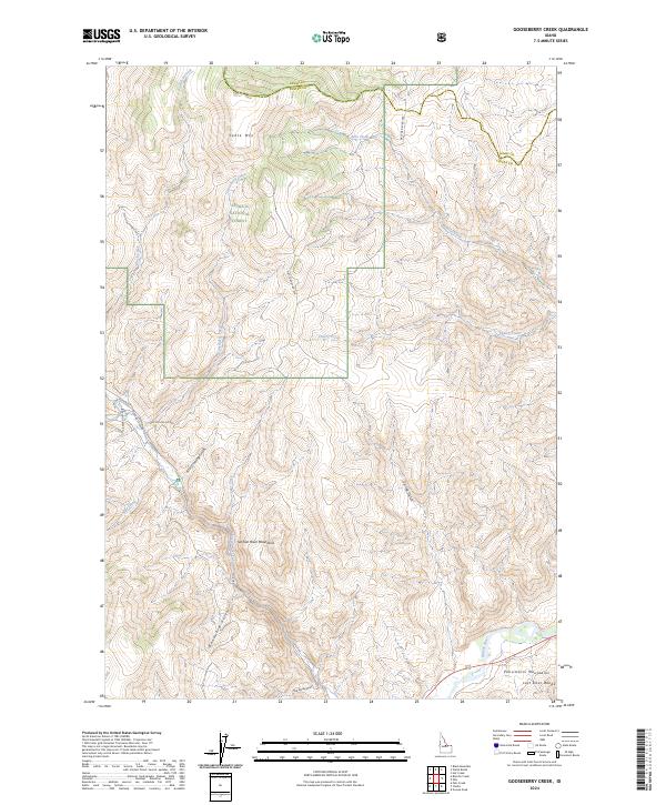
2024 Map of Gooseberry Creek
USGS Topo · Published 2024About this map
Challis National Forest dominates this high-elevation landscape where the Salmon River Mountains meet the northern reaches of the Lost River Range. The map detail captures the convergence of several major drainages, including Gooseberry Creek, Black Creek, and Ellis Creek, which carve deep canyons through the central highlands. This terrain is defined by its verticality, rising from the Salmon River corridor in the southeast toward prominent peaks like Table Mtn. The presence of Morgan Creek Rd and various Forest Service development roads, such as Nat For Dev RD 056, suggests a landscape managed for both timber and access. Steep gulches like Boneyard Gulch and First Crossing Gulch provide a granular look at the drainage patterns that have shaped Custer and Lemhi counties for generations.
Find a feature on this map
25 named features on this map. Tap any name to fly to it.
Don’t see what you’re looking for? This feature index may not catch every label — zoom into the map to look around manually.
Map Details
Editions of this 2024 Gooseberry Creek Map
This is the sole edition of this map. No revisions or reprints were ever made.
Other maps of this area

1956 · Challis
USGS Topo · 1:62,500

1956 · Twin Peaks
USGS Topo · 1:62,500

1957 · Challis
USGS Topo · 1:250,000

1960 · Challis
USGS Topo · 1:250,000

1963 · Challis
USGS Topo · 1:250,000
1963 · Black Mtn
USGS Topo · 1:24,000
1963 · Hat Creek
USGS Topo · 1:24,000
1963 · Wards Butte
USGS Topo · 1:24,000
1982 · Challis
USGS Topo · 1:100,000
1989 · Grouse Peak
USGS Topo · 1:24,000