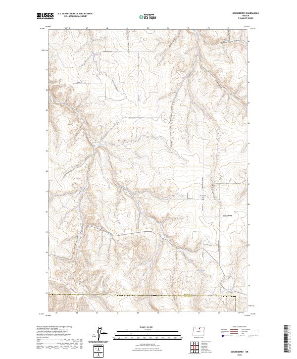
2024 Map of Gooseberry
USGS Topo · Published 2024About this map
Gooseberry occupies a landscape of steep-walled canyons and upland plateaus in the high country of Eastern Oregon. This 2024 map documents a rural environment where land is divided by deep drainage systems like Gooseberry Canyon and Eightmile Canyon, which feed toward the northern boundary. Settlement patterns are defined by family-named routes such as Carlson Ln, Gabbett Rd, and Mc Elligott Rd, reflecting the area's agricultural and ranching legacy. The small community of Gooseberry remains centered near the Gooseberry Cem, while the southern portion of the map traces the Morrow Co and Gilliam Co border. Water is a defining but intermittent presence, with the East Fork Dry Creek and West Fork Dry Creek cutting through the center, eventually leading to local features like Zinter Pond.
Find a feature on this map
33 named features on this map. Tap any name to fly to it.
Don’t see what you’re looking for? This feature index may not catch every label — zoom into the map to look around manually.
Map Details
Editions of this 2024 Gooseberry Map
This is the sole edition of this map. No revisions or reprints were ever made.
Other maps of this area

1916 · Condon
USGS Topo · 1:125,000

1953 · Pendleton
USGS Topo · 1:250,000

1953 · The Dalles
USGS Topo · 1:250,000

1956 · The Dalles
USGS Topo · 1:250,000

1956 · Pendleton
USGS Topo · 1:250,000

1957 · The Dalles
USGS Topo · 1:250,000

1968 · Gooseberry
USGS Topo · 1:24,000

1968 · Eightmile
USGS Topo · 1:24,000
1968 · Utts Butte
USGS Topo · 1:24,000

1968 · Ione South
USGS Topo · 1:24,000