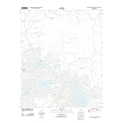
2011 Map of Goosepond Mountain
USGS Topo · Published 2011About this map
Hot Springs Village defines the southwestern portion of this landscape, showcasing the extensive development of a private master-planned community. The area is characterized by a dense network of residential streets winding around several large man-made reservoirs, including Lake Balboa, Lake Coronado, and Lake Cortez. These waters are controlled by infrastructure such as the Lake Coronado Dam and Pineda Dam, reflecting the mid-to-late 20th-century transition of this terrain from timberland to a recreational and residential hub.
Find a feature on this map
47 named features on this map. Tap any name to fly to it.
Don’t see what you’re looking for? This feature index may not catch every label — zoom into the map to look around manually.
Map Details
Editions of this 2011 Goosepond Mountain Map
This is the sole edition of this map. No revisions or reprints were ever made.
Other maps of this area

1890 · Benton
USGS Topo · 1:125,000

1890 · Hot Springs
USGS Topo · 1:125,000

1894 · Hot Springs
USGS Topo · 1:125,000

1894 · Benton
USGS Topo · 1:125,000

1955 · Little Rock
USGS Topo · 1:250,000

1956 · Little Rock
USGS Topo · 1:250,000

1960 · Little Rock
USGS Topo · 1:250,000

1963 · Paron SW
USGS Topo · 1:24,000

1963 · Paron
USGS Topo · 1:24,000

1964 · Little Rock
USGS Topo · 1:250,000