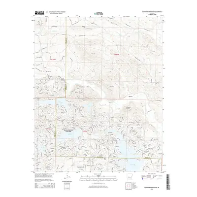
2014 Map of Goosepond Mountain
USGS Topo · Published 2014About this map
Hot Springs Village occupies the southern half of this landscape, showcasing a complex network of winding residential roads and managed water bodies. The community is structured around significant reservoirs including Lake Coronado, Lake Balboa, and Lake Pineda, which were engineered to follow the natural contours of the terrain. This development contrasts sharply with the northern portion of the map, which remains largely defined by the timber management roads of the Weyerhaeuser company and the natural drainage of Little Alum Fork and Angling Cr.
Find a feature on this map
39 named features on this map. Tap any name to fly to it.
Don’t see what you’re looking for? This feature index may not catch every label — zoom into the map to look around manually.
Map Details
Editions of this 2014 Goosepond Mountain Map
This is the sole edition of this map. No revisions or reprints were ever made.
Other maps of this area

1890 · Benton
USGS Topo · 1:125,000

1890 · Hot Springs
USGS Topo · 1:125,000

1894 · Hot Springs
USGS Topo · 1:125,000

1894 · Benton
USGS Topo · 1:125,000

1955 · Little Rock
USGS Topo · 1:250,000

1956 · Little Rock
USGS Topo · 1:250,000

1960 · Little Rock
USGS Topo · 1:250,000

1963 · Paron SW
USGS Topo · 1:24,000

1963 · Paron
USGS Topo · 1:24,000

1964 · Little Rock
USGS Topo · 1:250,000