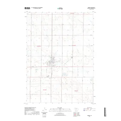
2017 Map of Gordon
USGS Topo · Published 2017About this map
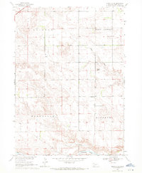
Gordon serves as the primary hub in this section of Sheridan County, Nebraska, where a grid of residential and commercial streets meets the agricultural landscape. The town is situated south of the sprawling Sandhills terrain, characterized by the winding path of Antelope Cr which flows across the central and eastern portions of the map. Local civic and historical identity is anchored at the Gordon Cem on the southern edge of the community, while the Gordon Municipal Airport to the east reflects the region's modern infrastructure. The surrounding area is defined by a rigorous grid of section lines and rural routes like 690th Rd and 650th Rd, punctuated by water management features such as Antelope Cr Reservoir 20-A. This survey provides a clear look at the intersection of prairie topography and the organized development of a Nebraska plains town.
Find a feature on this map
32 named features on this map. Tap any name to fly to it.
Don’t see what you’re looking for? This feature index may not catch every label — zoom into the map to look around manually.
Map Details
Editions of this 2017 Gordon Map
This is the sole edition of this map. No revisions or reprints were ever made.
Other maps of this area

1955 · Alliance
USGS Topo · 1:250,000

1957 · Alliance
USGS Topo · 1:250,000

1958 · Alliance
USGS Topo · 1:250,000

1969 · Gordon
USGS Topo · 1:24,000
1969 · Gordon SE
USGS Topo · 1:24,000

1969 · Clinton
USGS Topo · 1:24,000

1969 · Clinton NE
USGS Topo · 1:24,000
1969 · Rushville 4 NE
USGS Topo · 1:24,000
1969 · Rushville 4 NW
USGS Topo · 1:24,000
1969 · Rushville NE
USGS Topo · 1:24,000