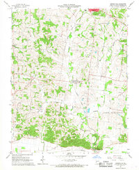
1967 Map of Gordonville
USGS Topo · Published 1968About this map
Gordonville and its surrounding rural townships in Cape Girardeau County are defined by a network of family-named cemeteries and country churches in the late 1960s. The Missouri Pacific railroad cuts a diagonal path through the landscape, following the valley of Hubble Creek from Jackson south toward Dutchtown. This corridor illustrates the historical reliance on rail and water for local transport and commerce between small agricultural hubs. Notable for genealogists are the numerous burial grounds marking the landscape, including Suedekum Cem, Eggimann Cem, and McGuire Cem, which reflect the deep-rooted settlement patterns of the area. Educational and social landmarks like the Oak Grove Sch and the Kimbeland Country Club provide insights into the community structure, while various denominations are represented by landmarks such as Immanuel Ch, St James Ch, and Zion Ch.
Find a feature on this map
36 named features on this map. Tap any name to fly to it.
Don’t see what you’re looking for? This feature index may not catch every label — zoom into the map to look around manually.
Map Details
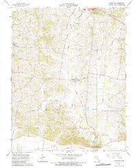
Editions of this 1967 Gordonville Map
2 editions found
Other maps of this area

1922 · Cape Girardeau
USGS Topo · 1:62,500

1924 · Cape Girardeau
USGS Topo · 1:62,500

1933 · Marble Hill
USGS Topo · 1:62,500

1934 · Morley
USGS Topo · 1:62,500

1934 · Advance
USGS Topo · 1:62,500

1937 · Marble Hill
USGS Topo · 1:62,500

1939 · Morley
USGS Topo · 1:62,500

1939 · Advance
USGS Topo · 1:62,500

1949 · Paducah
USGS Topo · 1:250,000

1950 · Paducah
USGS Topo · 1:250,000