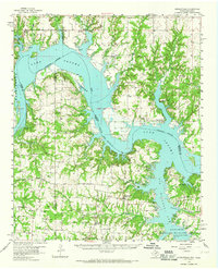
1958 Map of Gordonville
USGS Topo · Published 1965About this map
Lake Texoma dominates the landscape of this 1950s survey, illustrating the transformation of the Red River valley following the construction of the Denison Dam. The map captures a transitional era for North Texas and Southern Oklahoma, where rising waters created complex shorelines around former river settlements like Gordonville and Cedar Mills. Local industry is centered on the Sadler-Moulder-Mineral Oil Field and numerous gravel pits, while the south shore is anchored by the Hagerman National Wildlife Refuge. Cultural and academic footprints are visible at the Oklahoma University Biological Station and Texoma Christian Camp, alongside numerous rural landmarks such as Mt Zion Ch and Shay Cem that provide valuable data for genealogists tracing families in the Red River region before the suburban expansion of later decades.
Find a feature on this map
61 named features on this map. Tap any name to fly to it.
Don’t see what you’re looking for? This feature index may not catch every label — zoom into the map to look around manually.
Map Details
Editions of this 1958 Gordonville Map
2 editions found
Other maps of this area

1901 · Tishomingo
USGS Topo · 1:125,000

1901 · Ardmore
USGS Topo · 1:125,000

1901 · Denison
USGS Topo · 1:125,000

1902 · Gainesville
USGS Topo · 1:125,000

1918 · Ardmore
USGS Topo · 1:125,000

1943 · Gainesville
USGS Topo · 1:125,000

1954 · Sherman
USGS Topo · 1:250,000

1957 · Ardmore
USGS Topo · 1:250,000

1958 · Gordonville
USGS Topo · 1:62,500

1958 · Denison Dam
USGS Topo · 1:62,500