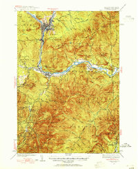
1937 Map of Gorham
USGS Topo · Published 1955About this map
The industrial activity at Berlin and the recreational development of the White Mountains converge on this 1930s survey. The Androscoggin River dominates the northern landscape, supporting the Berlin settlement where the Grand Trunk Railroad and Berlin Sta served as vital transportation nodes. Southward, the landscape shifts toward the vast wilderness of the White Mountain National Forest, where the early infrastructure of mountain tourism is visible through sites like the Glen House, the Mountaineer Club Cabin, and various shelters along the Appalachian Trail. Evidence of New Deal-era labor appears at the CCC Camp near Martins Brook, while industrial remnants like the Mascot Pit near Leadmine Brook suggest the area's mineral interests. The transition from the settled valleys of Gorham and Shelburne to high peaks like Carter Dome and Wildcat Mtn is meticulously documented via a dense network of hiking and ski trails established before the Second World War.
Find a feature on this map
137 named features on this map. Tap any name to fly to it.
Don’t see what you’re looking for? This feature index may not catch every label — zoom into the map to look around manually.
Map Details
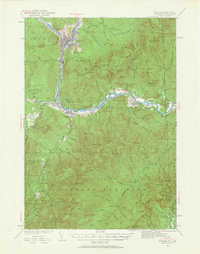
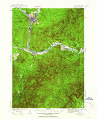
Editions of this 1937 Gorham Map
6 editions found


Other maps of this area

1893 · Mt. Washington
USGS Topo · 1:62,500

1893 · Gorham
USGS Topo · 1:62,500

1894 · North Conway
USGS Topo · 1:62,500

1895 · Crawford Notch
USGS Topo · 1:62,500

1896 · Mt. Washington
USGS Topo · 1:62,500

1896 · Crawford Notch
USGS Topo · 1:62,500

1896 · North Conway
USGS Topo · 1:62,500

1896 · Gorham
USGS Topo · 1:62,500

1909 · Fryeburg
USGS Topo · 1:62,500

1911 · Fryeburg
USGS Topo · 1:62,500