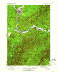
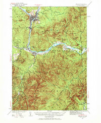
1937 Map of Gorham
USGS Topo · Published 1961About this map
Berlin and Gorham anchor this 1930s survey of the Presidential Range's northern reaches, where the industrial presence of the Boston and Maine railroad meets the expansive wilderness of the White Mountain National Forest. The Androscoggin River serves as the central artery for settlements like Cascade and Upper Village, while the surrounding peaks are punctuated by early hiking infrastructure. Shelters and huts, including the Nansen Hut and the Mountaineer Club Cabin, reflect the era's growing recreational culture along the Appalachian Trail and Mahosuc Trail.
Find a feature on this map
108 named features on this map. Tap any name to fly to it.
Don’t see what you’re looking for? This feature index may not catch every label — zoom into the map to look around manually.
Map Details
Editions of this 1937 Gorham Map
6 editions found

Other maps of this area

1893 · Mt. Washington
USGS Topo · 1:62,500

1893 · Gorham
USGS Topo · 1:62,500

1894 · North Conway
USGS Topo · 1:62,500

1895 · Crawford Notch
USGS Topo · 1:62,500

1896 · Mt. Washington
USGS Topo · 1:62,500

1896 · Crawford Notch
USGS Topo · 1:62,500

1896 · North Conway
USGS Topo · 1:62,500

1896 · Gorham
USGS Topo · 1:62,500

1909 · Fryeburg
USGS Topo · 1:62,500

1911 · Fryeburg
USGS Topo · 1:62,500