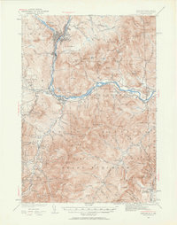
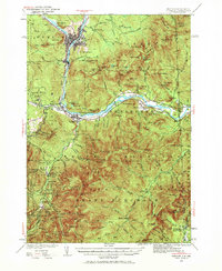
1937 Map of Gorham
USGS Topo · Published 1961About this map
The Androscoggin River carves a deep valley through this corner of the White Mountains, serving as the industrial and transportation corridor for Berlin and Gorham. In the late 1930s, the region was already a premier destination for backcountry recreation, evidenced by an extensive network of footpaths including the Appalachian Trail, Mahoosuc Trail, and Baldface Circle Trail. The map captures the infrastructure of early mountain tourism, from the Mountaineer Club Cabin and AMC Hut to the historic Glen House and Toll House at the base of the peaks.
Find a feature on this map
105 named features on this map. Tap any name to fly to it.
Don’t see what you’re looking for? This feature index may not catch every label — zoom into the map to look around manually.
Map Details
Editions of this 1937 Gorham Map
6 editions found

Other maps of this area

1893 · Mt. Washington
USGS Topo · 1:62,500

1893 · Gorham
USGS Topo · 1:62,500

1894 · North Conway
USGS Topo · 1:62,500

1895 · Crawford Notch
USGS Topo · 1:62,500

1896 · Mt. Washington
USGS Topo · 1:62,500

1896 · Crawford Notch
USGS Topo · 1:62,500

1896 · North Conway
USGS Topo · 1:62,500

1896 · Gorham
USGS Topo · 1:62,500

1909 · Fryeburg
USGS Topo · 1:62,500

1911 · Fryeburg
USGS Topo · 1:62,500