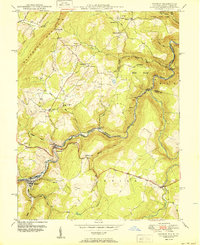
1950 Map of Gorman
USGS Topo · Published 1950About this map
The North Branch Potomac River serves as the winding boundary between Maryland and West Virginia in this mid-century survey, anchoring the settlements of Gorman and Gormania. The Western Maryland railroad snakes along the riverbanks, connecting industrial points like Bayard and Wallman to the broader coal and timber regions. High above the river valley, the terrain is defined by The Little Backbone Mountain and the Potomac State Forest, where early industrial footprints like a Strip Mine appear near Bethlehem School.
Find a feature on this map
49 named features on this map. Tap any name to fly to it.
Don’t see what you’re looking for? This feature index may not catch every label — zoom into the map to look around manually.
Map Details
Editions of this 1950 Gorman Map
2 editions found
Other maps of this area

1895 · Piedmont
USGS Topo · 1:125,000

1899 · Oakland
USGS Topo · 1:62,500

1900 · Oakland
USGS Topo · 1:62,500

1916 · Davis
USGS Topo · 1:48,000

1918 · Davis
USGS Topo · 1:62,500

1919 · Elk Garden
USGS Topo · 1:48,000

1919 · Davis
USGS Topo · 1:62,500

1920 · Elk Garden
USGS Topo · 1:48,000

1920 · Davis
USGS Topo · 1:48,000

1921 · Greenland Gap
USGS Topo · 1:62,500