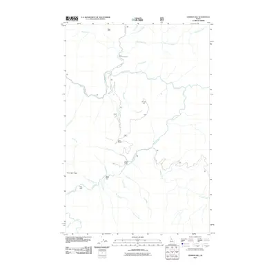
2011 Map of Gorman Hill
USGS Topo · Published 2011About this map
Kelly Creek and Cayuse Creek dominate this backcountry landscape, defining a network of drainages that includes Little Moose Creek and Spruce Creek. The terrain is marked by distinctive local landmarks such as Gorman Hill, Ruby Point, and the remarkably named Never Again Ridge, which rises above Never Again Flats. Human infrastructure is sparse, concentrated primarily along Moose Creek Rd and Co Rd 581. The remote nature of the area is highlighted by the presence of the Cayuse Creek Airport, a small airstrip providing access to these upper reaches of the drainage. For outdoor recreationists and land managers, the Ruby Creek Campground serves as a primary point of interest along the northern waters. This 2011 survey captures the primitive road system and natural geography before any major shifts in forest management or access.
Find a feature on this map
30 named features on this map. Tap any name to fly to it.
Don’t see what you’re looking for? This feature index may not catch every label — zoom into the map to look around manually.
Map Details
Editions of this 2011 Gorman Hill Map
This is the sole edition of this map. No revisions or reprints were ever made.
Other maps of this area

1911 · Lolo
USGS Topo · 1:250,000

1913 · Lolo
USGS Topo · 1:250,000

1956 · Hamilton
USGS Topo · 1:250,000

1959 · Hamilton
USGS Topo · 1:250,000

1960 · Hamilton
USGS Topo · 1:250,000

1960 · Straight Peak
USGS Topo · 1:62,500

1964 · Hamilton
USGS Topo · 1:250,000

1965 · Osier Ridge
USGS Topo · 1:24,000
1965 · Moose Mtn
USGS Topo · 1:24,000

1965 · Scurvy Mtn.
USGS Topo · 1:24,000