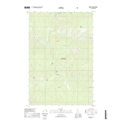
2020 Map of Gorman Hill
USGS Topo · Published 2020About this map
Shoecraft and Gorman Grave Site sits as a lonely historical marker within the high backcountry of the Clearwater National Forest. This remote section of north-central Idaho is defined by a dense network of drainages including Kelly Creek, Cayuse Creek, and Little Moose Cr, which cut through a landscape of named high points like Gorman Hill and Ruby Point. The presence of the Cayuse Creek USFS Airport near the confluence of Shoecraft Cr suggests the importance of aerial access in managing this wilderness terrain. Local nomenclature reveals a history of struggle or unique events, evidenced by features such as Never Again Ridge and the nearby Never Again Flats. The map provides a detailed view of the transition from river bottoms at Pony Flats to the steep divides of Independence Ridge and Pollock Ridge, documenting the land's character long after its initial mapping.
Find a feature on this map
50 named features on this map. Tap any name to fly to it.
Don’t see what you’re looking for? This feature index may not catch every label — zoom into the map to look around manually.
Map Details
Editions of this 2020 Gorman Hill Map
This is the sole edition of this map. No revisions or reprints were ever made.
Other maps of this area

1911 · Lolo
USGS Topo · 1:250,000

1913 · Lolo
USGS Topo · 1:250,000

1956 · Hamilton
USGS Topo · 1:250,000

1959 · Hamilton
USGS Topo · 1:250,000

1960 · Hamilton
USGS Topo · 1:250,000

1960 · Straight Peak
USGS Topo · 1:62,500

1964 · Hamilton
USGS Topo · 1:250,000

1965 · Osier Ridge
USGS Topo · 1:24,000
1965 · Moose Mtn
USGS Topo · 1:24,000

1965 · Scurvy Mtn.
USGS Topo · 1:24,000