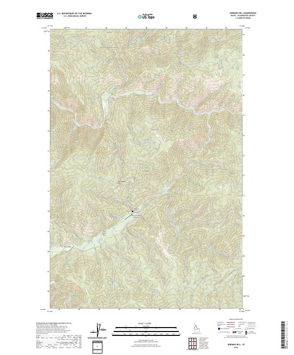
2024 Map of Gorman Hill
USGS Topo · Published 2024About this map
Shoecraft and Gorman Grave Site provides a poignant historical anchor for this portion of the Clearwater National Forest, where steep Idaho drainage basins define the landscape. The topographic character is dominated by the Moose Mountains and prominent features like Gorman Hill and the long stretch of Never Again Ridge. This 2024 survey captures a remote wilderness interior largely managed for forestry and conservation, as evidenced by the Cayuse Creek USFS Airport tucked near the banks of Shoecraft Creek. The naming conventions found here—from Pony Flats to Laundry Ridge Swamp Creek—suggest a history of early logging, packing, and forest service occupancy. A network of primitive routes like Moose Creek Rd and Co Rd 581 provides the only overland access through these high-elevation valleys.
Find a feature on this map
47 named features on this map. Tap any name to fly to it.
Don’t see what you’re looking for? This feature index may not catch every label — zoom into the map to look around manually.
Map Details
Editions of this 2024 Gorman Hill Map
This is the sole edition of this map. No revisions or reprints were ever made.
Other maps of this area

1911 · Lolo
USGS Topo · 1:250,000

1913 · Lolo
USGS Topo · 1:250,000

1956 · Hamilton
USGS Topo · 1:250,000

1959 · Hamilton
USGS Topo · 1:250,000

1960 · Hamilton
USGS Topo · 1:250,000

1960 · Straight Peak
USGS Topo · 1:62,500

1964 · Hamilton
USGS Topo · 1:250,000

1965 · Osier Ridge
USGS Topo · 1:24,000
1965 · Moose Mtn
USGS Topo · 1:24,000

1965 · Scurvy Mtn.
USGS Topo · 1:24,000