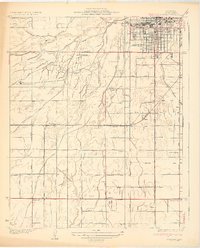
1932 Map of Gosford
USGS Topo · Published 1932About this map
Bakersfield and its agricultural southern outskirts are defined by an intricate network of irrigation infrastructure in this early 1930s survey. The landscape is carved by numerous man-made waterways including the Buena Vista Canal, Stine Canal, and Kern Island Canal, which diverted the Kern River to fuel the region's burgeoning farming industry. Local education is well-represented by rural outposts like Union Ave Sch and Stine Sch, while the presence of the Stockdale Country Club and the Airway Beacon indicate the early modernization and suburban expansion of the Kern County seat.
Find a feature on this map
57 named features on this map. Tap any name to fly to it.
Don’t see what you’re looking for? This feature index may not catch every label — zoom into the map to look around manually.
Map Details
Editions of this 1932 Gosford Map
3 editions found
Other maps of this area

1906 · Bakersfield
USGS Topo · 1:62,500

1910 · Buena Vista Lake
USGS Topo · 1:125,000

1912 · Buena Vista Lake
USGS Topo · 1:125,000

1914 · Caliente
USGS Topo · 1:125,000

1929 · Stevens
USGS Topo · 1:31,680

1929 · Fairfax School
USGS Topo · 1:31,680

1930 · Weed Patch
USGS Topo · 1:31,680

1930 · Millux
USGS Topo · 1:31,680

1930 · Rosedale
USGS Topo · 1:31,680

1930 · Conner
USGS Topo · 1:31,680