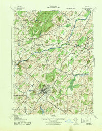
1943 Map of Goshen
USGS Topo · Published 1943About this map
The village of Goshen serves as the focal point of this 1940s survey, showing a well-developed rail and institutional landscape. The Erie railroad and the New York Ontario and Western line intersect near the town center, supporting local industry like Bordens Dairy and the Sewage Disposal Plant. Academic and medical institutions are prominent throughout the area, including the Selesian School, the Interpines Hospital, and Our Lady of the Blessed Sacrament Academy situated to the south.
Find a feature on this map
42 named features on this map. Tap any name to fly to it.
Don’t see what you’re looking for? This feature index may not catch every label — zoom into the map to look around manually.
Map Details
Editions of this 1943 Goshen Map
This is the sole edition of this map. No revisions or reprints were ever made.
Other maps of this area

1902 · Schunemunk
USGS Topo · 1:62,500

1903 · Newburg
USGS Topo · 1:62,500

1904 · Ellenville
USGS Topo · 1:62,500

1906 · Ellenville
USGS Topo · 1:62,500

1906 · Goshen
USGS Topo · 1:62,500

1908 · Goshen
USGS Topo · 1:62,500

1930 · Schunemunk
USGS Topo · 1:48,000

1935 · Schunemunk
USGS Topo · 1:62,500

1938 · Goshen
USGS Topo · 1:62,500

1942 · Pine Island
USGS Topo · 1:24,000