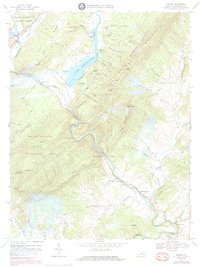
1967 Map of Goshen
USGS Topo · Published 1983About this map
Lake Merriweather and the narrow corridor of Goshen Pass dominate this landscape where the Calfpasture River and Little River meet to form the Maury River. The terrain is defined by the sharp ridges of Little North Mountain and Jump Mountain, creating a natural bottleneck for the Chesapeake and Ohio railroad. Small settlements like Rockbridge Baths and Glendye are situated along these waterways, reflecting the region's history as a site for both early transit and seasonal recreation. Numerous Boy Scout camps, including Camp Virginia and Camp Olmsted, are established around the lake and river branches. Local genealogy is anchored by sites like Bethesda Ch and the Little River Cem, while the Maury Monument commemorates the area's physical geography.
Find a feature on this map
74 named features on this map. Tap any name to fly to it.
Don’t see what you’re looking for? This feature index may not catch every label — zoom into the map to look around manually.
Map Details
Editions of this 1967 Goshen Map
Other maps of this area

1894 · Staunton
USGS Topo · 1:125,000

1894 · Natural Bridge
USGS Topo · 1:125,000

1894 · Lexington
USGS Topo · 1:125,000

1901 · Monterey
USGS Topo · 1:125,000

1932 · Lexington
USGS Topo · 1:48,000

1937 · Lexington
USGS Topo · 1:62,500

1943 · Craigsville
USGS Topo · 1:62,500

1945 · Craigsville
USGS Topo · 1:62,500

1946 · Millboro
USGS Topo · 1:62,500

1946 · Williamsville
USGS Topo · 1:62,500