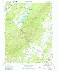
1967 Map of Goshen
USGS Topo · Published 1979About this map
Lake Merriweather dominates the northern landscape of this Rockbridge County region, fed by the Little Calfpasture River. The map highlights a significant cluster of scout camps along the lake's western and northern shores, including Camp Olmsted, Camp Marriott, and Camp Ross. This mid-century view captures the transition of the wilderness into a recreational hub while preserving the rural character of established settlements.
Find a feature on this map
61 named features on this map. Tap any name to fly to it.
Don’t see what you’re looking for? This feature index may not catch every label — zoom into the map to look around manually.
Map Details
Editions of this 1967 Goshen Map
Other maps of this area

1894 · Staunton
USGS Topo · 1:125,000

1894 · Natural Bridge
USGS Topo · 1:125,000

1894 · Lexington
USGS Topo · 1:125,000

1901 · Monterey
USGS Topo · 1:125,000

1932 · Lexington
USGS Topo · 1:48,000

1937 · Lexington
USGS Topo · 1:62,500

1943 · Craigsville
USGS Topo · 1:62,500

1945 · Craigsville
USGS Topo · 1:62,500

1946 · Millboro
USGS Topo · 1:62,500

1946 · Williamsville
USGS Topo · 1:62,500