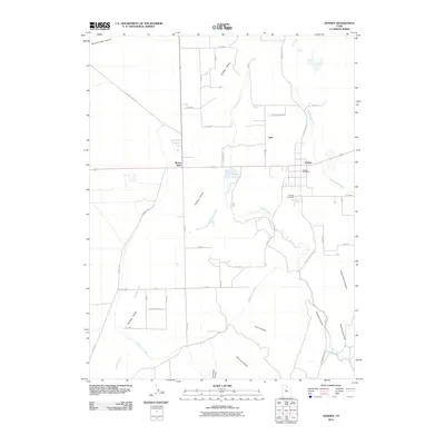
2011 Map of Goshen
USGS Topo · Published 2011About this map
Goshen serves as the primary settlement in this part of the Goshen Valley, where the landscape is defined by an intricate network of irrigation and water management. The Warm Springs Ditch and the Currant Creek Canal cut across the terrain, reflecting the agricultural character of the region. Local heritage is centered around the Goshen Post Office and the nearby Goshen Cemetery, while the small community of Lant and the landmark at Mount Nebo anchor the northern reaches of the survey.
Find a feature on this map
43 named features on this map. Tap any name to fly to it.
Don’t see what you’re looking for? This feature index may not catch every label — zoom into the map to look around manually.
Map Details
Editions of this 2011 Goshen Map
This is the sole edition of this map. No revisions or reprints were ever made.
Other maps of this area

1885 · Salt Lake
USGS Topo · 1:250,000

1885 · Manti
USGS Topo · 1:250,000

1885 · Sevier Desert
USGS Topo · 1:250,000

1885 · Tooele Valley
USGS Topo · 1:250,000

1895 · Manti
USGS Topo · 1:250,000

1947 · Fivemile Pass
USGS Topo · 1:62,500

1947 · Allens Ranch
USGS Topo · 1:24,000

1949 · Eureka
USGS Topo · 1:24,000

1949 · Allens Ranch
USGS Topo · 1:24,000

1950 · West Mountain
USGS Topo · 1:24,000