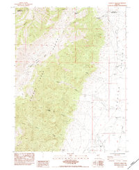
1984 Map of Goshute Creek
USGS Topo · Published 1984About this map
The Cherry Creek Range dominates this landscape, rising above the western edge of Steptoe Valley along the border of Elko and White Pine counties. This mid-1980s record captures a high-desert ranching environment where water management is central to human activity. A network of irrigation ditches, including the P. Ditch and several segments of Int. Ditch, distribute water from the mountain runoff to the valley floor.
Find a feature on this map
27 named features on this map. Tap any name to fly to it.
Don’t see what you’re looking for? This feature index may not catch every label — zoom into the map to look around manually.
Map Details
Editions of this 1984 Goshute Creek Map
This is the sole edition of this map. No revisions or reprints were ever made.
Other maps of this area

1955 · Elko
USGS Topo · 1:250,000

1956 · Ely
USGS Topo · 1:250,000

1958 · Elko
USGS Topo · 1:250,000

1959 · Ely
USGS Topo · 1:250,000

1962 · Elko
USGS Topo · 1:250,000

1963 · Ely
USGS Topo · 1:250,000

1965 · Elko
USGS Topo · 1:250,000

1982 · Exchequer Spring
USGS Topo · 1:24,000

1982 · Cherry Spring
USGS Topo · 1:24,000
1982 · Goshute Lake South
USGS Topo · 1:24,000