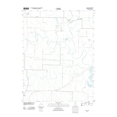
2012 Map of Goss
USGS Topo · Published 2012About this map
Goss sits near the southern edge of this Monroe County landscape, positioned along the rural roads that navigate a complex network of waterways. The eastern portion of the sheet is dominated by the sprawling reach of Mark Twain Lake, where the North Fork Salt River and Otter Creek converge. This drainage system includes numerous named tributaries like Crooked Creek and Dales Branch, which carve through the terrain to reach the reservoir.
Find a feature on this map
63 named features on this map. Tap any name to fly to it.
Don’t see what you’re looking for? This feature index may not catch every label — zoom into the map to look around manually.
Map Details
Editions of this 2012 Goss Map
This is the sole edition of this map. No revisions or reprints were ever made.
Other maps of this area

1890 · Mexico
USGS Topo · 1:125,000

1890 · Moberly
USGS Topo · 1:125,000

1903 · Palmyra
USGS Topo · 1:125,000

1945 · Florida
USGS Topo · 1:62,500

1948 · Quincy
USGS Topo · 1:250,000

1953 · Moberly
USGS Topo · 1:250,000

1954 · Moberly
USGS Topo · 1:250,000

1956 · Quincy
USGS Topo · 1:250,000

1957 · Moberly
USGS Topo · 1:250,000

1959 · Shelbina
USGS Topo · 1:24,000