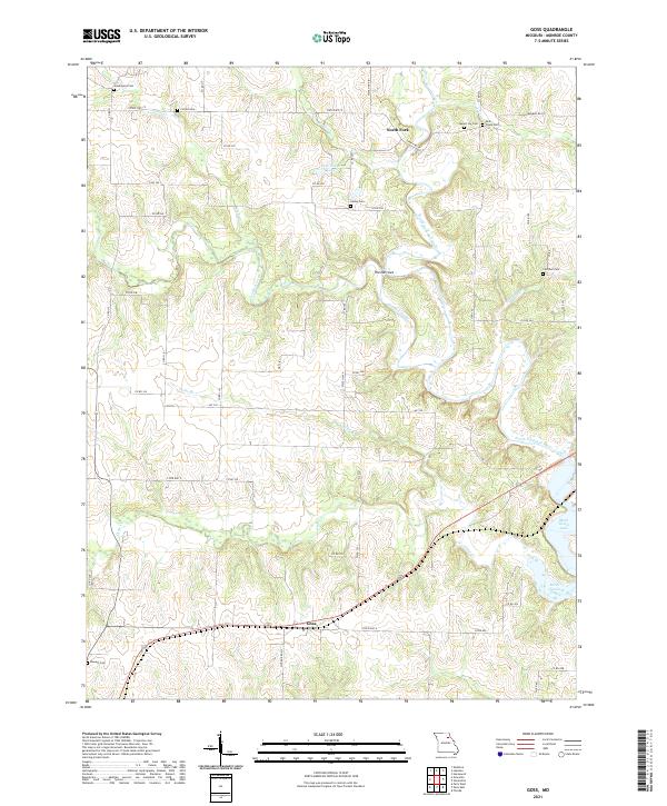
2021 Map of Goss
USGS Topo · Published 2021About this map
The North Fork Salt River and the eastern reaches of Mark Twain Lake dominate this rural Monroe County landscape. Near the settlement of Goss, the terrain is defined by the winding paths of Crooked Creek and several smaller tributaries like Dales Br and Crutcher Br. The topography is particularly striking at The Narrows, where the river's path creates a distinct landform.
Find a feature on this map
56 named features on this map. Tap any name to fly to it.
Don’t see what you’re looking for? This feature index may not catch every label — zoom into the map to look around manually.
Map Details
Editions of this 2021 Goss Map
This is the sole edition of this map. No revisions or reprints were ever made.
Other maps of this area

1890 · Mexico
USGS Topo · 1:125,000

1890 · Moberly
USGS Topo · 1:125,000

1903 · Palmyra
USGS Topo · 1:125,000

1945 · Florida
USGS Topo · 1:62,500

1948 · Quincy
USGS Topo · 1:250,000

1953 · Moberly
USGS Topo · 1:250,000

1954 · Moberly
USGS Topo · 1:250,000

1956 · Quincy
USGS Topo · 1:250,000

1957 · Moberly
USGS Topo · 1:250,000

1959 · Shelbina
USGS Topo · 1:24,000