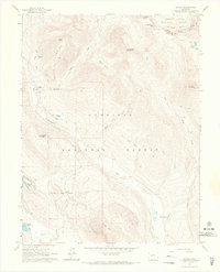
1961 Map of Gothic
USGS Topo · Published 1967About this map
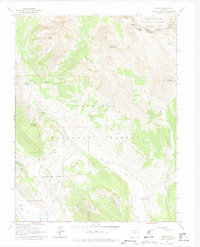
The high-altitude settlement of Gothic stands as a focal point in the rugged Elk Mountains, situated near Judd Falls and the drainage of Copper Creek. This 1961 field-checked survey reveals a landscape of transition, where the historic mining era leaves traces such as the local Cemetery and various Mine sites, while new recreational infrastructure like a Ski Tow and Gondola Lift appear near the base of Crested Butte. The map captures the meeting point of the White River National Forest and Gunnison National Forest along the high ridges of the Elk Mountains.
Find a feature on this map
38 named features on this map. Tap any name to fly to it.
Don’t see what you’re looking for? This feature index may not catch every label — zoom into the map to look around manually.
Map Details
Editions of this 1961 Gothic Map
7 editions found
Other maps of this area

1888 · Crested Butte
USGS Topo · 1:62,500

1888 · Anthracite
USGS Topo · 1:62,500

1889 · Crested Butte
USGS Topo · 1:62,500

1889 · Anthracite
USGS Topo · 1:62,500

1893 · Anthracite
USGS Topo · 1:62,500

1893 · Crested Butte
USGS Topo · 1:62,500

1893 · Aspen
USGS Topo · 1:62,500

1894 · Anthracite
USGS Topo · 1:62,500

1895 · Aspen
USGS Topo · 1:62,500

1909 · Mount Jackson
USGS Topo · 1:125,000