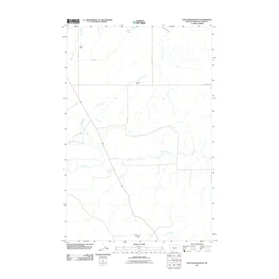
2011 Map of Gouchnour Ranch
USGS Topo · Published 2011About this map
Gouchnour Ranch and Eberl Ranch anchor this landscape of Lewis and Clark County, revealing the critical role of water management in Montana's agricultural heartland. The intricate network of irrigation is visible through features like Lame Ditch, Lytle Clemons Ditch, and the curiously named Detergent Dam on Hogan Creek. This 2011 survey captures a rural environment where seasonal water flow and drainage dictate the layout of homesteads and roads. Named waterways such as Spring Creek, Dry Creek, and Hogan Slough weave through the terrain, while Meyer Lake provides a permanent water source in the northern section. Local travel is facilitated by a grid of named routes including Allen Rd, Bob Thomas Rd, and Camp Walker Rd, connecting these remote ranching operations to the wider region.
Find a feature on this map
14 named features on this map. Tap any name to fly to it.
Don’t see what you’re looking for? This feature index may not catch every label — zoom into the map to look around manually.
Map Details
Editions of this 2011 Gouchnour Ranch Map
This is the sole edition of this map. No revisions or reprints were ever made.
Other maps of this area

1920 · Choteau
USGS Topo · 1:125,000

1943 · Hogan
USGS Topo · 1:125,000

1955 · Choteau
USGS Topo · 1:250,000

1957 · Choteau
USGS Topo · 1:250,000

1958 · Choteau
USGS Topo · 1:250,000

1960 · Gilman
USGS Topo · 1:62,500
1960 · Freezeout Lake
USGS Topo · 1:62,500

1962 · Choteau
USGS Topo · 1:250,000
1962 · Bowmans Corners
USGS Topo · 1:24,000
1963 · Bowmans Corners NW
USGS Topo · 1:24,000