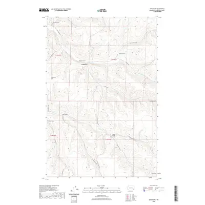
2020 Map of Gould City
USGS Topo · Published 2020About this map
Gould City sits at the heart of this Garfield County landscape, where the deeply incised drainages of the Snake River plateau define the local geography. The area's settlement pattern is tied closely to these coulees, with landmarks like Ben Day Gulch and Heaton Gulch named for the families who worked this high wheat country. The map details a sophisticated network of early transit routes, including Gould City-Mayview Rd and Mc Grann Hill Rd, which follow the natural contours of the land to connect isolated homesteads. Water sources such as Coyote Spring and the various forks of Deadman Cr provide a look at the essential resources that supported ranching and dryland farming in the eastern Washington interior. From the prominence of Wild Horse Hill down to the bottomlands of Smith Gulch, this survey records the enduring footprint of rural development.
Find a feature on this map
31 named features on this map. Tap any name to fly to it.
Don’t see what you’re looking for? This feature index may not catch every label — zoom into the map to look around manually.
Map Details
Editions of this 2020 Gould City Map
This is the sole edition of this map. No revisions or reprints were ever made.
Other maps of this area

1910 · Pullman
USGS Topo · 1:125,000

1937 · Pomeroy
USGS Topo · 1:96,000

1942 · Pomeroy
USGS Topo · 1:125,000

1943 · Peola
USGS Topo · 1:62,500

1946 · Peola
USGS Topo · 1:62,500

1950 · Penawawa
USGS Topo · 1:62,500

1955 · Pullman
USGS Topo · 1:250,000

1958 · Pullman
USGS Topo · 1:250,000

1964 · Kirby
USGS Topo · 1:24,000
1964 · Almota
USGS Topo · 1:24,000