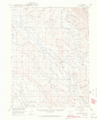
1956 Map of Gould
USGS Topo · Published 1969About this map
The Canadian River and Michigan River define the high-altitude ranching and mining landscape of this mid-century Colorado survey. Anchored by the settlements of Gould and Rand, the area exhibits a clear pattern of land use centered on water and timber resources, with the Roosevelt National Forest and Routt National Forest dominating the high country of the Medicine Bow Mountains. The valley floors are dotted with family-held holdings such as Smith Ranch and Three Rivers Ranch, while higher elevations indicate a history of extraction at the Manning Mine and Sudduth Mine.
Find a feature on this map
80 named features on this map. Tap any name to fly to it.
Don’t see what you’re looking for? This feature index may not catch every label — zoom into the map to look around manually.
Map Details
Editions of this 1956 Gould Map
2 editions found
Other maps of this area

1915 · Longs Peak
USGS Topo · 1:125,000

1916 · Home
USGS Topo · 1:125,000

1919 · Rocky Mountain National Park
USGS Topo · 1:125,000

1920 · Home
USGS Topo · 1:125,000

1954 · Greeley
USGS Topo · 1:250,000

1954 · Craig
USGS Topo · 1:250,000

1955 · Eagle Hill
USGS Topo · 1:24,000

1955 · Gould
USGS Topo · 1:24,000

1955 · Owl Ridge
USGS Topo · 1:24,000

1955 · Shipman Mountain
USGS Topo · 1:24,000