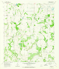
1962 Map of Gouldbusk
USGS Topo · Published 1964About this map
Gouldbusk and the surrounding rural landscape of Coleman County are depicted here in the early 1960s, a period defined by small ranching communities and local gathering places. The settlement of Gouldbusk is situated near the winding course of Bull Creek, while the village of Shields lies to the northeast. Local social life is anchored by institutions such as Sant Willow Ch, Double Gates Ch, and the High Sch located near Mozelle. The map also reveals the area's geological utility through numerous Gravel Pits and a Quarry scattered throughout the territory. Notable water infrastructure is present in the northwest corner, where a Riser and Spillway manage local drainage, alongside a prominent Pipeline cutting through the eastern sections of the quadrangle.
Find a feature on this map
15 named features on this map. Tap any name to fly to it.
Don’t see what you’re looking for? This feature index may not catch every label — zoom into the map to look around manually.
Map Details
Editions of this 1962 Gouldbusk Map
This is the sole edition of this map. No revisions or reprints were ever made.
Other maps of this area

1887 · Coleman
USGS Topo · 1:125,000

1889 · Coleman
USGS Topo · 1:125,000

1892 · Eden
USGS Topo · 1:125,000

1892 · Ballinger
USGS Topo · 1:125,000

1894 · Brady
USGS Topo · 1:125,000

1896 · Eden
USGS Topo · 1:125,000

1924 · Eden 1-a
USGS Topo · 1:48,000

1924 · Brady 2-a
USGS Topo · 1:48,000

1925 · Brady 2-b
USGS Topo · 1:48,000

1928 · Waldrip
USGS Topo · 1:62,500