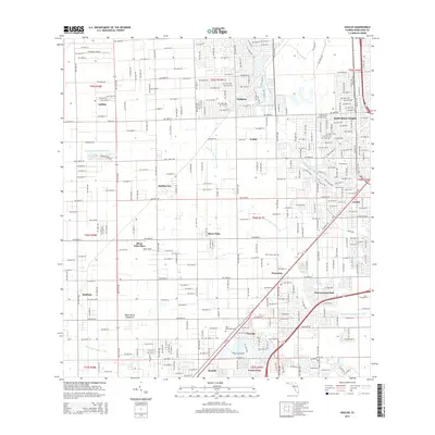
2015 Map of Goulds
USGS Topo · Published 2015About this map
Aladdin City and South Miami Heights anchor this portrait of the Miami-Dade County landscape, where suburban expansion meets legacy agricultural tracts. The map illustrates a strictly gridded network of streets and canals, including the Black Creek Canal No C-1 W and the Princeton Canal Number C-102, which were essential for managing water across this flat coastal plain. Scattered among the residential blocks are landmarks like Silver Palm Place and Mac's Field, alongside several established communities like Princeton, Naranja, and Goulds. The presence of the Busway running parallel to the arterial roads highlights the evolution of transit in the region. Local history and genealogy interests are served by the identification of the Silver Green Cem and Palm Memorial Cem, while the Bauer Drive Hammock indicates the preservation of native ecological pockets within the developed grid.
Find a feature on this map
138 named features on this map. Tap any name to fly to it.
Don’t see what you’re looking for? This feature index may not catch every label — zoom into the map to look around manually.
Map Details
Editions of this 2015 Goulds Map
This is the sole edition of this map. No revisions or reprints were ever made.
Other maps of this area

1949 · South Miami NW
USGS Topo · 1:24,000

1949 · Arsenicker Keys
USGS Topo · 1:24,000

1949 · Goulds
USGS Topo · 1:24,000

1949 · Perrine
USGS Topo · 1:24,000

1950 · Homestead
USGS Topo · 1:24,000

1950 · South Miami
USGS Topo · 1:24,000

1955 · South Miami NW
USGS Topo · 1:24,000

1956 · Goulds
USGS Topo · 1:24,000

1956 · Perrine
USGS Topo · 1:24,000

1956 · South Miami
USGS Topo · 1:24,000