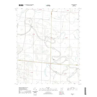
2020 Map of Gourd
USGS Topo · Published 2020About this map
Bayou Bartholomew dictates the geography of this Delta region, carving deep, serpentine meanders through the fertile bottomlands of Lincoln, Drew, and Desha counties. The settlement of Gourd sits near a distinctive oxbow known as The Gourd, where the watercourse nearly doubles back on itself. The landscape is a network of slow-moving hydraulics, characterized by features like Gibson Brake, Bear Slough, and Mills Slough, which highlight the intricate drainage patterns essential to this agricultural corridor. Local history is anchored by rural landmarks such as Curtis Hall Cem, Taylor Cem, and Cypress Grove Cem. Transport and property lines follow the long-established township and range system, with State Hwy 138 and various county roads, including Nevada Rd and Co Rd 37, providing access to the river bends at Raddish Bend and Slide Off-Bend.
Find a feature on this map
53 named features on this map. Tap any name to fly to it.
Don’t see what you’re looking for? This feature index may not catch every label — zoom into the map to look around manually.
Map Details
Editions of this 2020 Gourd Map
This is the sole edition of this map. No revisions or reprints were ever made.
Other maps of this area

1935 · Cominto
USGS Topo · 1:62,500

1935 · Rotan
USGS Topo · 1:62,500

1935 · Red Fork
USGS Topo · 1:62,500

1936 · McGehee
USGS Topo · 1:62,500

1937 · McGehee
USGS Topo · 1:62,500

1953 · Greenwood
USGS Topo · 1:250,000

1955 · McGehee
USGS Topo · 1:62,500

1956 · Greenwood
USGS Topo · 1:250,000

1960 · Selma
USGS Topo · 1:24,000

1960 · Collins NW
USGS Topo · 1:24,000