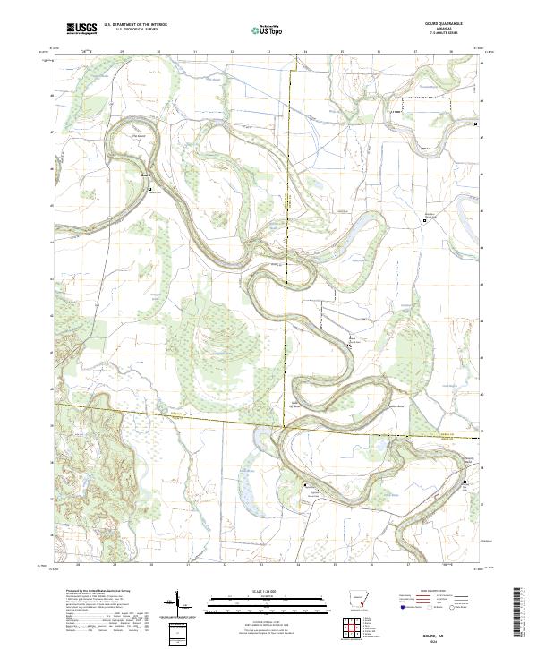
2024 Map of Gourd
USGS Topo · Published 2024About this map
Bayou Bartholomew dictates the geography of this Arkansas landscape, winding through the intersections of Lincoln, Desha, and Drew counties. This environment is defined by its oxbow lakes and backwater brakes, including Arrington Brake, Campbells Brake, and Fletcher Brake. These stagnant water bodies, alongside Wells Bayou and Choctaw Bayou, mark the ancient path of the river system as it meanders across the flat alluvial plain. The settlement of Gourd sits at a prominent bend known as The Gourd, where local heritage is preserved in sites like the Gourd Cem. The map reveals a deeply rooted rural community, traced through numerous small burial grounds and churches such as Saint Paul Church Cem, Serene Church Cem, and Morning Star Cem, many located at the termini of quiet rural routes like Nevada Rd and Co RD 412.
Find a feature on this map
57 named features on this map. Tap any name to fly to it.
Don’t see what you’re looking for? This feature index may not catch every label — zoom into the map to look around manually.
Map Details
Editions of this 2024 Gourd Map
This is the sole edition of this map. No revisions or reprints were ever made.
Other maps of this area

1935 · Cominto
USGS Topo · 1:62,500

1935 · Rotan
USGS Topo · 1:62,500

1935 · Red Fork
USGS Topo · 1:62,500

1936 · McGehee
USGS Topo · 1:62,500

1937 · McGehee
USGS Topo · 1:62,500

1953 · Greenwood
USGS Topo · 1:250,000

1955 · McGehee
USGS Topo · 1:62,500

1956 · Greenwood
USGS Topo · 1:250,000

1960 · Selma
USGS Topo · 1:24,000

1960 · Collins NW
USGS Topo · 1:24,000