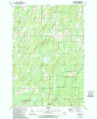
1989 Map of Gourley
USGS Topo · Published 1989About this map
Gourley serves as the central settlement in this late 20th-century view of Menominee County, situated amid a landscape defined by complex hydrology and timber management. The northern reaches of the Escanaba River State Forest dominate the southeastern quadrant, where the terrain transitions into protected woodlands and recreational space including a Campground. The map reveals a remote rural economy punctuated by numerous Gravel Pits and a small Landing Strip, suggesting the continued importance of aviation for access to this northern forest region.
Find a feature on this map
21 named features on this map. Tap any name to fly to it.
Don’t see what you’re looking for? This feature index may not catch every label — zoom into the map to look around manually.
Map Details
Editions of this 1989 Gourley Map
This is the sole edition of this map. No revisions or reprints were ever made.
Other maps of this area

1932 · Bark River NE
USGS Topo · 1:31,680

1949 · Stephenson
USGS Topo · 1:48,000

1954 · Escanaba
USGS Topo · 1:250,000

1957 · Escanaba
USGS Topo · 1:250,000

1958 · Escanaba
USGS Topo · 1:250,000

1963 · Bark River
USGS Topo · 1:62,500

1963 · Powers
USGS Topo · 1:62,500

1963 · Cedar River
USGS Topo · 1:62,500

1963 · Stephenson
USGS Topo · 1:62,500

1981 · Marinette
USGS Topo · 1:100,000