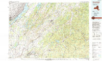
1985 Map of Gouverneur
USGS Topo · Published 1993About this map
The St Lawrence River and its iconic Thousand Islands anchor the northwestern edge of this 1985 survey, illustrating a landscape defined by the intersection of international waterways and dense Upstate New York forests. The Oswegatchie River snakes through the central terrain, passing through the industrial and residential hub of Gouverneur, while the Fort Drum Military Reservation occupies a massive footprint to the south.
Find a feature on this map
62 named features on this map. Tap any name to fly to it.
Don’t see what you’re looking for? This feature index may not catch every label — zoom into the map to look around manually.
Map Details
Editions of this 1985 Gouverneur Map
2 editions found
Other maps of this area

1893 · Sackets Harbor
USGS Topo · 1:62,500

1895 · Sacketts Harbor
USGS Topo · 1:62,500

1895 · Watertown
USGS Topo · 1:62,500

1898 · Watertown
USGS Topo · 1:62,500

1900 · Clayton
USGS Topo · 1:62,500

1902 · Carthage
USGS Topo · 1:62,500

1903 · Big Moose
USGS Topo · 1:62,500

1903 · Grindstone
USGS Topo · 1:62,500

1903 · Clayton
USGS Topo · 1:62,500

1903 · Alexandria Bay
USGS Topo · 1:62,500