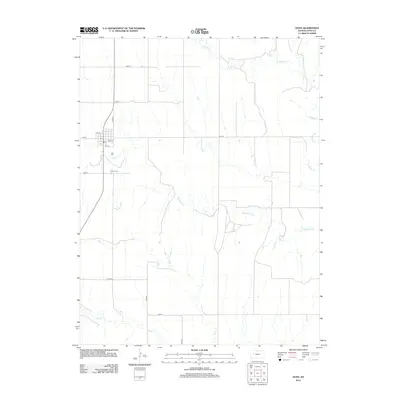
2012 Map of Gove
USGS Topo · Published 2012About this map
Gove serves as the focal point of this High Plains landscape, situated near the confluence of several prairie drainages. The small grid of the settlement is defined by local thoroughfares such as 4th St and 5th St, and it is supported by a local Post Office. This 2012 survey illustrates a classic Western Kansas land pattern, where section-line roads like Gove 46 and Gove R carve the terrain into a predictable geometric grid. The natural geography breaks this order with the wandering paths of Hackberry Creek, E Spring Creek, and Indian Creek. Genealogists and local historians will find the Gove Cemetery south of the main townsite, a critical landmark for tracing the families who settled this Gove County seat.
Find a feature on this map
19 named features on this map. Tap any name to fly to it.
Don’t see what you’re looking for? This feature index may not catch every label — zoom into the map to look around manually.
Map Details
Editions of this 2012 Gove Map
This is the sole edition of this map. No revisions or reprints were ever made.
Other maps of this area

1954 · Goodland
USGS Topo · 1:250,000

1955 · Scott City
USGS Topo · 1:250,000

1956 · Goodland
USGS Topo · 1:250,000

1957 · Goodland
USGS Topo · 1:250,000

1958 · Scott City
USGS Topo · 1:250,000

1972 · Gove NE
USGS Topo · 1:24,000

1972 · Orion NE
USGS Topo · 1:24,000

1972 · Gove
USGS Topo · 1:24,000

1974 · Gove SW
USGS Topo · 1:24,000

1974 · Gove SE
USGS Topo · 1:24,000