
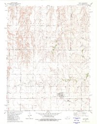
1974 Map of Gove SE
USGS Topo · Published 1976About this map
The Butterfield Overland Trail cuts across this Gove County landscape, marking the path of the historic mail and passenger route through western Kansas. Situated between the townships of Payne and Larrabee, the terrain is defined by the drainage basins of Indian Creek and the Smoky Hill River. The map illustrates a shift from nineteenth-century transit toward modern energy production, evidenced by the numerous oil wells and designated oil fields scattered across the northern and southern sections. Genealogists can locate specific burial grounds including Morning Star Cem in the north and Alanthus Cem near the river bluffs, while the township boundaries of Jerome and Baker provide a clear spatial framework for rural homestead research.
Find a feature on this map
12 named features on this map. Tap any name to fly to it.
Don’t see what you’re looking for? This feature index may not catch every label — zoom into the map to look around manually.
Map Details
Editions of this 1974 Gove SE Map
This is the sole edition of this map. No revisions or reprints were ever made.
Other maps of this area

1955 · Scott City
USGS Topo · 1:250,000

1958 · Scott City
USGS Topo · 1:250,000

1972 · Gove NE
USGS Topo · 1:24,000

1972 · Castle Rock NW
USGS Topo · 1:24,000

1972 · Gove
USGS Topo · 1:24,000

1974 · Gove SW
USGS Topo · 1:24,000

1974 · Castle Rock
USGS Topo · 1:24,000

1974 · Shields NW
USGS Topo · 1:24,000

1974 · Pendennis
USGS Topo · 1:24,000
1981 · Utica
USGS Topo · 1:24,000