
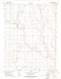
1974 Map of Gove SW
USGS Topo · Published 1976About this map
The Butterfield Overland Trail cuts a historic path across this High Plains landscape, following the southern reaches of Jerome toward the valley of the Smoky Hill River. The terrain is defined by the drainage systems of Indian Creek and Plum Creek, which carve into the tablelands of Gove County. In the mid-1970s, this area reflects a rural economy rooted in both traditional agriculture and natural resource extraction. The presence of the Missouri Flats Sch provides a waypoint for local history, while scattered Oil Wells, a Caliche Pit, and multiple Sandpits indicate the industrial footprint of the era. Extensive Feedlot operations near the river further illustrate the intensive land use characterizing the western Kansas plains during this period of the twentieth century.
Find a feature on this map
13 named features on this map. Tap any name to fly to it.
Don’t see what you’re looking for? This feature index may not catch every label — zoom into the map to look around manually.
Map Details
Editions of this 1974 Gove SW Map
This is the sole edition of this map. No revisions or reprints were ever made.
Other maps of this area

1955 · Scott City
USGS Topo · 1:250,000

1958 · Scott City
USGS Topo · 1:250,000

1972 · Gove NE
USGS Topo · 1:24,000

1972 · Orion NE
USGS Topo · 1:24,000

1972 · Gove
USGS Topo · 1:24,000

1974 · Cheyenne Creek
USGS Topo · 1:24,000

1974 · Gove SE
USGS Topo · 1:24,000
1974 · Orion SE
USGS Topo · 1:24,000

1974 · Shields NW
USGS Topo · 1:24,000

1974 · Pendennis
USGS Topo · 1:24,000