
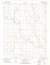
1972 Map of Gove
USGS Topo · Published 1974About this map
Gove (Gove City) serves as the primary seat of activity in this 1970s High Plains landscape, situated at the confluence of local section roads and the meandering Hackberry Creek. The township structure is clearly defined by the boundary between Gove and Payne, reflecting the systematic agricultural organization of the Kansas prairie. Numerous wells and water sources are indicated across the terrain, emphasizing the critical role of groundwater for the surrounding homesteads and ranching operations.
Find a feature on this map
11 named features on this map. Tap any name to fly to it.
Don’t see what you’re looking for? This feature index may not catch every label — zoom into the map to look around manually.
Map Details
Editions of this 1972 Gove Map
This is the sole edition of this map. No revisions or reprints were ever made.
Other maps of this area

1954 · Goodland
USGS Topo · 1:250,000

1955 · Scott City
USGS Topo · 1:250,000

1956 · Goodland
USGS Topo · 1:250,000

1957 · Goodland
USGS Topo · 1:250,000

1958 · Scott City
USGS Topo · 1:250,000

1972 · Gove NE
USGS Topo · 1:24,000

1972 · Orion NE
USGS Topo · 1:24,000

1974 · Gove SW
USGS Topo · 1:24,000

1974 · Gove SE
USGS Topo · 1:24,000
1974 · Orion SE
USGS Topo · 1:24,000